“Because in the end, you won’t remember the time you spent working in the office or mowing your lawn.
Climb that goddamn mountain.”
Jack Kerouac
Date: Saturday May 18, 2019
Time: Meet at trailhead parking lot 10am . Begin hike at 10:30am.
Difficulty: Moderate
Distance: 7.7 miles
Elevation Gain: 1,187 feet
This is a moderate “out-and-back” hike to the summit of Mount Umunhum. About 3.8 miles each way. There is no water along the way so bring plenty.
Click here for the address of the parking lot for Mt. Umunhum trailhead:
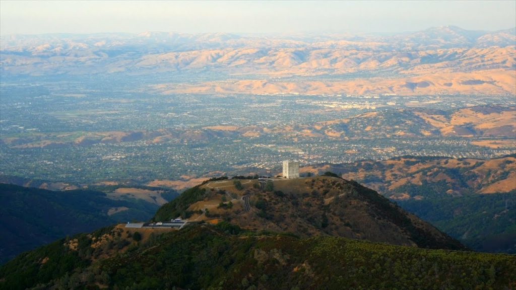
Mount Umunhum (Ohlone, meaning resting place of the hummingbird) is the fourth-highest peak in California’s Santa Cruz Mountains (after Loma Prieta, Crystal Peak, and Mt. Chual). The mountain is situated in Santa Clara County, south of San Jose. It is sometimes referred to as Mount Um by locals. Most of the mountain is within the Sierra Azul Open Space Preserve…….. Read more from Wikipedia here.
If you want to learn more about the history of Mount Umunhum, check out this great YouTube video.
UPDATE: I did this hike on May 18, 2019 with my brother and loved it. PLEASE NOTE: as of 5/18/19 – the trail to the summit is OPEN despite what it says on some hiking Apps. The trail is extremely well maintained. I’ve never seen a trail so well groomed. It’s really an easy hike. It never gets steep. Excellent signage along the way. It took us 2 hours to get to the summit from Bald Head parking lot and about 1 hour 20 minutes to come down at a very leisurely pace. It rained or drizzled the entire time and was quite windy. I highly recommend this hike.